


Cover may vary - this is a stock image
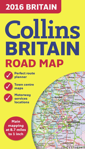
2016 Collins Map of Britain
Format: Map
What do the conditions mean?
Our conditions mean the following:
- New - a brand new book
- Almost New - appears new but is actually secondhand.
- Very Good - only minor imperfections such as minor scuffs to edge or cover or a price written in pencil or shop sticker.
- Standard Secondhand - Clearly been read before, but not too bad. We do not recommend these for gifting. Spines usually creased. Could also include creases or folds to cover, some writing such as in the cover or elsewhere, underlining or highlighting, but might not do. Possibly some stains or marks. Similar in general to books in any secondhand shop or charity shop.
- Poor Condition - Usually this will have a specific problem such as writing inside, water damage, missing dust jacket, heavy staining, large creases or cuts. These are readable copies but not nice ones. On other websites this condition is called 'Acceptable' or 'Fair' , but we want to be more honest.
Low stock: 1 left


Full colour double-sided map of Great Britain at 8.7 miles to 1 inch (1:550,000), with clear, detailed road network and administrative areas shown in colour.
With its political colouring of counties and unitary authorities it is ideal for business users but it is also perfect for tourists as a route planning map.


MAIN FEATURES
- Fully updated for 2016.
- Counties and local council areas shown in colour.
- Clear, detailed road network.
- Town and city names, rivers, railway lines and canals are clearly shown.
- 16 city/town centre street plans.
- Index to place names.
- Mileage chart.
- Car ferry routes.
- Key in English, French and German.
AREA OF COVERAGE
Double-sided road map covering the whole of Britain. Northern England, Scotland and the Isle of Man are on one side with Southern England and Wales on the other.
Author: Collins Maps (all their books in stock)
Genre: Reference, Atlases & Maps
Format: Map
Published: 2015
Pages: 1
Publisher: Harper Collins Publishers
ISBN: 9780008102333
Payment method
Condition Descriptions
Our conditions mean the following:
- New - a brand new book
- Almost New - appears new but is actually secondhand.
- Very Good - only minor imperfections such as minor scuffs to edge or cover or a price written in pencil or shop sticker.
- Standard Secondhand - Clearly been read before, but not too bad. We do not recommend these for gifting. Spines usually creased. Could also include creases or folds to cover, some writing such as in the cover or elsewhere, underlining or highlighting, but might not do. Possibly some stains or marks. Similar in general to books in any secondhand shop or charity shop.
- Poor Condition - Usually this will have a specific problem such as writing inside, water damage, missing dust jacket, heavy staining, large creases or cuts. These are readable copies but not nice ones. On other websites this condition is called 'Acceptable' or 'Fair' , but we want to be more honest.
Shipping and Delivery
- Free UK shipping over £10.
- Under £10, shipping is £1.99.
- Express shipping £2.99.
- Choose 10 £1 books for £10 including shipping!
- International shipping available to select countries, proceed to checkout to see prices.
Return
Return books within 14 days if not happy.
More £1 travel books
All £1 books →-

-

-

Cotswold Images
£1.00£1.00 -
-

Bugs, Bites and Bowels : travel health
£1.00£1.00 -


