


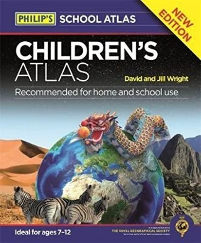
Cover may vary - this is a stock image
Philip's Children's Atlas
Format: Hardback
What do the conditions mean?
Our conditions mean the following:
- New - a brand new book
- Almost New - appears new but is actually secondhand.
- Very Good - only minor imperfections such as minor scuffs to edge or cover or a price written in pencil or shop sticker.
- Standard Secondhand - Clearly been read before, but not too bad. We do not recommend these for gifting. Spines usually creased. Could also include creases or folds to cover, some writing such as in the cover or elsewhere, underlining or highlighting, but might not do. Possibly some stains or marks. Similar in general to books in any secondhand shop or charity shop.
- Poor Condition - Usually this will have a specific problem such as writing inside, water damage, missing dust jacket, heavy staining, large creases or cuts. These are readable copies but not nice ones. On other websites this condition is called 'Acceptable' or 'Fair' , but we want to be more honest.
Low stock: 1 left


In Philip's Children's Atlas, clear and accurate maps are combined with fascinating facts about the countries of the world to provide essential geographical information for young readers. In addition, guidance is given at the beginning of the atlas on how to use the maps, encouraging the early development of map skills. The atlas is organized spread by spread in the classic sequence: first Europe, then its land neighbour Asia, followed by Africa, Australia and Oceania, North America and South America. Illustrated with interesting full-colour photographs and packed with fact boxes, curiosities, flags, stamps and quiz questions, Philip's Children's Atlas is both fun to use and easy to understand. A past winner of the Geographical Association's award for making a significant contribution to geography, Philip's Children's Atlas was judged "an excellent 'all round' children's atlas with simple yet well-designed maps, well-illustrated with colour photographs. It links places to issues, events and real people, giving a clear sense of place."


Author: David Wright (all their books in stock)
Genre: Children's non-fiction, Reference
Format: Hardback
Published: 2016
Pages: 96
Publisher: Philip's
ISBN: 9781849074094
Payment method
Condition Descriptions
Our conditions mean the following:
- New - a brand new book
- Almost New - appears new but is actually secondhand.
- Very Good - only minor imperfections such as minor scuffs to edge or cover or a price written in pencil or shop sticker.
- Standard Secondhand - Clearly been read before, but not too bad. We do not recommend these for gifting. Spines usually creased. Could also include creases or folds to cover, some writing such as in the cover or elsewhere, underlining or highlighting, but might not do. Possibly some stains or marks. Similar in general to books in any secondhand shop or charity shop.
- Poor Condition - Usually this will have a specific problem such as writing inside, water damage, missing dust jacket, heavy staining, large creases or cuts. These are readable copies but not nice ones. On other websites this condition is called 'Acceptable' or 'Fair' , but we want to be more honest.
Shipping and Delivery
- Free UK shipping over £10.
- Under £10, shipping is £1.99.
- Express shipping £2.99.
- Choose 10 £1 books for £10 including shipping!
- International shipping available to select countries, proceed to checkout to see prices.
Return
Return books within 14 days if not happy.
More £1 children’s books
All £1 books →-

-
 by Kiran Millwood Hargrave
The Girl of Ink and Stars: winner of the British Book Awards' Children's Book of the Year
£1.00£1.00 -
-

-

-


