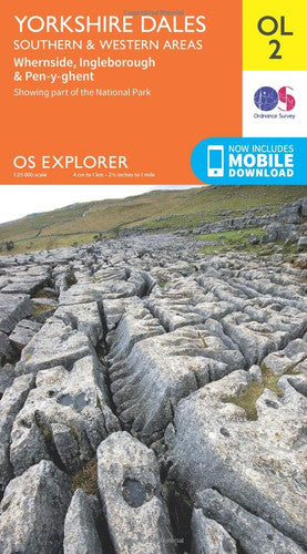
Cover may vary - this is a stock image
Yorkshire Dales Map | Southern & Western | Ordnance Survey | OS Explorer Map OL2 | England | Walks | Hiking | Maps | AdventureOL02
What do the conditions mean?
Our conditions mean the following:
- New - a brand new book
- Almost New - appears new but is actually secondhand.
- Very Good - only minor imperfections such as minor scuffs to edge or cover or a price written in pencil or shop sticker.
- Standard Secondhand - Clearly been read before, but not too bad. We do not recommend these for gifting. Spines usually creased. Could also include creases or folds to cover, some writing such as in the cover or elsewhere, underlining or highlighting, but might not do. Possibly some stains or marks. Similar in general to books in any secondhand shop or charity shop.
- Poor Condition - Usually this will have a specific problem such as writing inside, water damage, missing dust jacket, heavy staining, large creases or cuts. These are readable copies but not nice ones. On other websites this condition is called 'Acceptable' or 'Fair' , but we want to be more honest.
Low stock: 1 left
The essential map for outdoor activities in Yorkshire Dales - Southern & Western areas. The OS Explorer Map is the Ordnance Survey's most detailed folding map and is recommended for anyone enjoying outdoor activities including walking, horse riding and off-road cycling. This map now comes with a digital version which you can download to your smartphone or tablet.FeaturesPennine WayDales WayDales Way (Guide Book)Ribble WayLimestone Link (Cumbria)Lune Valley RambleMillennium WayPennine Way (National Trail)E2 (European Long Distance Route)SettleSkiptonNorth YorkshireLancashireYorkshire Dales National ParkCumbria1:25 000 scale (4 cm to 1 km - 2.5 inches to 1 mile)This map comes with a digital version which you can download to your smartphone or tablet.
Format: Map
Published: 2016
Publisher: Ordnance Survey
ISBN: 9780319263310
Share
Payment method
Condition Descriptions
Our conditions mean the following:
- New - a brand new book
- Almost New - appears new but is actually secondhand.
- Very Good - only minor imperfections such as minor scuffs to edge or cover or a price written in pencil or shop sticker.
- Standard Secondhand - Clearly been read before, but not too bad. We do not recommend these for gifting. Spines usually creased. Could also include creases or folds to cover, some writing such as in the cover or elsewhere, underlining or highlighting, but might not do. Possibly some stains or marks. Similar in general to books in any secondhand shop or charity shop.
- Poor Condition - Usually this will have a specific problem such as writing inside, water damage, missing dust jacket, heavy staining, large creases or cuts. These are readable copies but not nice ones. On other websites this condition is called 'Acceptable' or 'Fair' , but we want to be more honest.
Shipping and Delivery
- Free UK shipping over £10.
- Under £10, shipping is £1.99.
- Express shipping £2.99.
- Choose 10 £1 books for £10 including shipping!
- International shipping available to select countries, proceed to checkout to see prices.
Return
Return books within 14 days if not happy.
Share